Active tourism
Put yourself to the test in an unparalleled natural environment
Active tourism
Put yourself to the test in an unparalleled natural environment
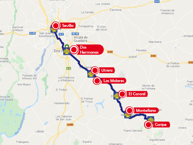
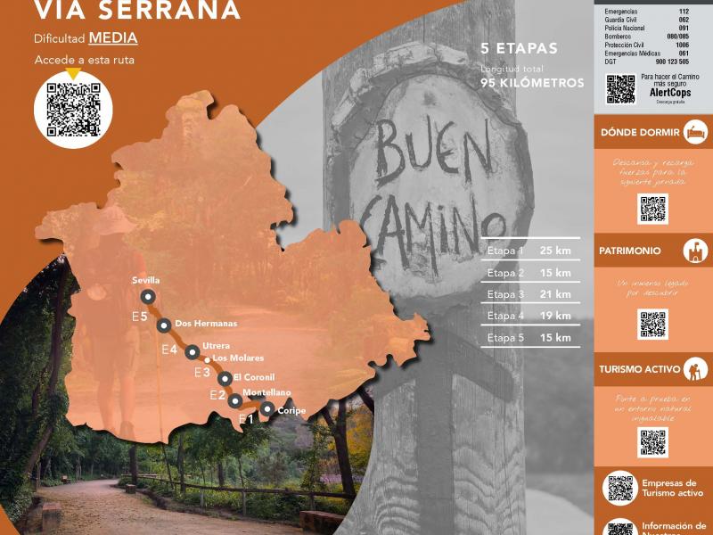
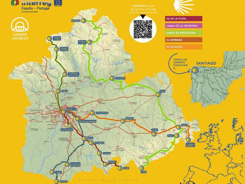
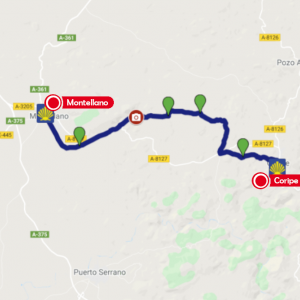
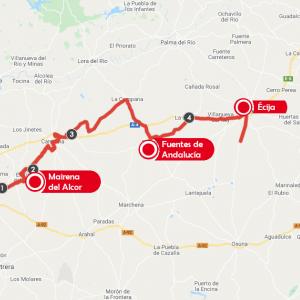
Leaving the Peñón de Zaframagón behind, and continuing along the Sierra Greenway, you will come to the planned Zaframagón station. Continue until you leave the tunnel before Coripe station, turning to walk on the tarmac of the local road, and climbing a steep slope to the first town. However, when you come to a picnic area, you can change to a path parallel to the road, which makes for much easier walking.
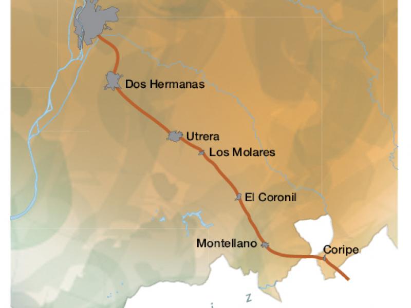
In Coripe you come to the Plaza de San Pedro with the church of the same name, where you receive the pilgrim's stamp. The old street soon becomes a dirt track. You cross the Boquinete stream, after which the path veers to the right and climbs upwards. At some points it can be rocky and stony. Shortly afterwards you descend again and cross the Gilete stream which runs over the Camino. Then it climbs again, loses height again and meets the road. Keep to the left until you reach a crossroads. Turn right onto the Morón and Algodonales track which runs between wire fences for over a kilometre until you come to a path on your left which leads to the Fuensolana farmhouse. From here, you walk northwards until you reach a meeting of ways. The one you have to take is the least noticeable, and veers to the right along a wide valley where it gains height. It is well worth stopping to admire the view back over the hilly and mountainous landscape. When you reach the top, continue to your left as far as a building, where a country lane starts on the left, leading you to the stream of La Mujer (Women's Stream). Turn left along the track beside the stream, which soon becomes a clear wide path. Further on the path becomes flat again and there is an information panel with the positions of some 13th century towers in the region. The tower you have been seeing for a long time on the top of the mountain next to the quarry, which is also marked on the panel, belongs to Cote castle. You now take the path to the left of the road (Cañada Real de Ronda (Ronda Royal Cattle Track)), and as you continue through the fields you will see Montellano in the distance. After passing through plots of land protected by wire fences, and then through an olive grove, you turn right and then left.
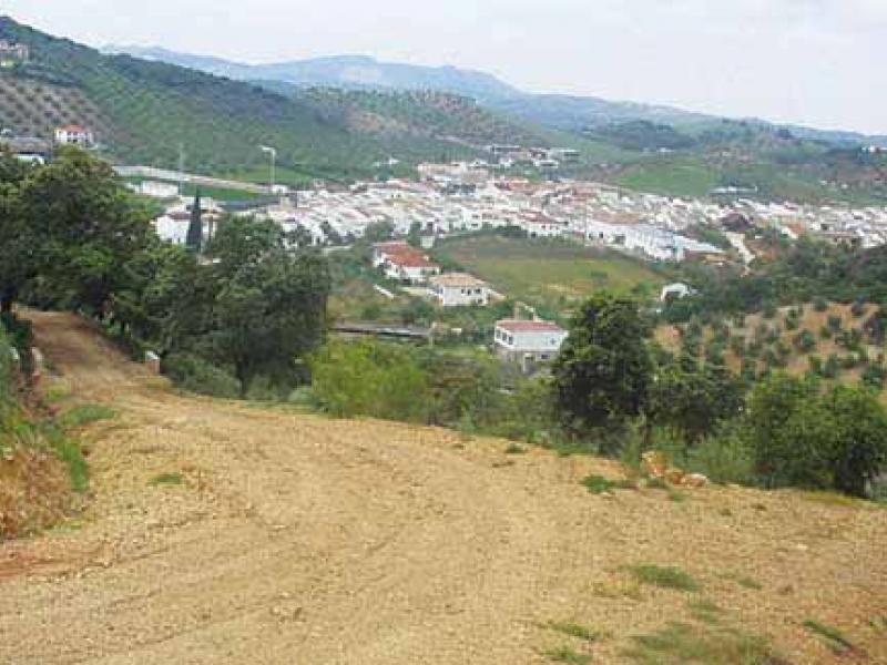
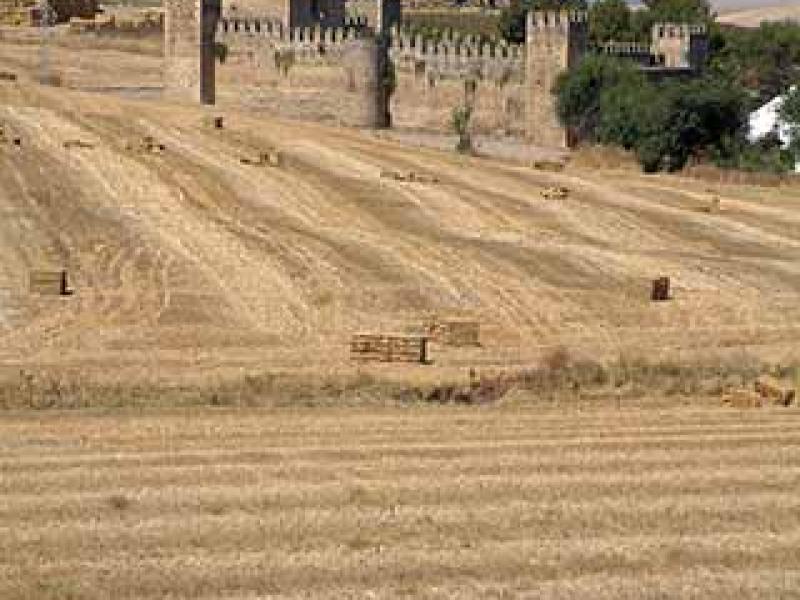
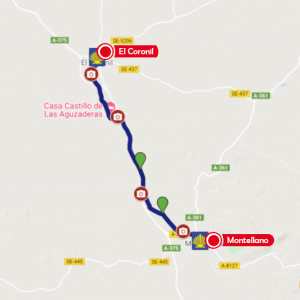
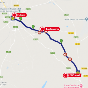
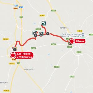
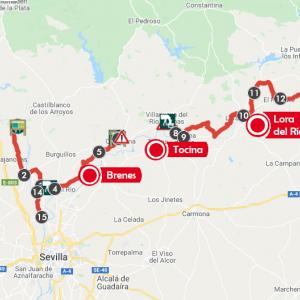
In Montellano you can receive the pilgrim's stamp in the parish church of Señor San José. Leave the town on the A-375 until you reach a fork in the road where you take a dirt track to the left, and then go down across the fields and through an olive grove until you come to another fork. Here you take the path to the left, towards the Huertero estate. Then take the path to the right and then to the left again. You come to the iron gate of a cattle shed and take the path to the right. The path soon loses height, and you reach a barrier with a lake on the right. A few metres further on a country lane starts on the left, which you follow straight on. This path, which is flat at first, starts a gentle climb and then descends towards the Salado stream, where you come across an old, ruined bridge. Cross the stream (with some difficulty) and carry on as far as the San Sebastián inn. From here, continue along the road, which coincides with the royal Ronda-Seville cattle track, to the castle of Las Aguzaderas (there is a spring there). From here, a path starts on the left. It is clearly defined at first, but then becomes a little vaguer. After crossing the road, you enter the village of El Coronil. At the church of Nuestra Señora de Consolación you can receive the pilgrim's stamp. You leave along Calle Real towards the old SE-436 road and turn left onto the old road from Los Molares to El Coronil, passing the farmhouses of Guardainfantilla and Pardales and joining the old road from Utrera to Morón de la Frontera. The road winds its way across the countryside, through the fields and across agricultural land, with few trees to provide shade. You go straight across a crossroads, where occasional streams cross the path and can make it wet and boggy. You soon reach the SE-9011, which you go straight across and continue along the path on the other side, taking the first turning to the left, which leads directly to Los Molares. You cross the village and continue along the same road from Utrera to Morón de la Frontera, arriving at a wide, dusty dirt track, which you follow straight on, crossing a canal, and arriving in Utrera.
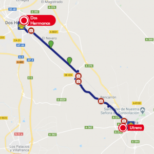
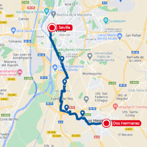
Beside the church of Santiago runs the Via Augusta. The pilgrim can choose between two alternatives to continue the route: either along the old medieval muleteer's road to Alcalá de Guadaíra (Cuesta Carretilla road), or along the Utrera path to reach Seville via the ancient Roman road of Orippo (Dos Hermanas). You leave the land of the macaroons and walk as far as the A-362 bridge over the railway. You cross the bridge, then go down a steep staircase to the right and come to the wall of the cemetery. You are now on the Utrera path, which you follow through bushes and conifers, accompanied by birdsong, to reach a densely wooded and leafy area near the old farmhouse of Don Rodrigo. From there you carry on to the local SE-425 road and continue to the right until you cross the railway tracks on to the the right-hand side. Continue straight on along the right-hand side of the railway line to the Cantaelgallo station, on the way into Dos Hermanas. Following Sta. María Magdalena street we arrive at La Motilla. We will continue towards Fuente del Rey until we reach Avenida de Jerez.
Only 5.7 kms. remain for you to reach Seville Cathedral via the avenues of Palmera, Delicias, Roma and Constitución.
0 comments
New comment
The comments are moderated, so it takes a while to appear. If they contain offensive language they will not be published.